Non est ad astra mollis e terris via
Seneca wrote, and he sure knew what he was talking about. There is no gentle and earthly way to the stars. It doesn’t have to be the stars, though. A saint would do.
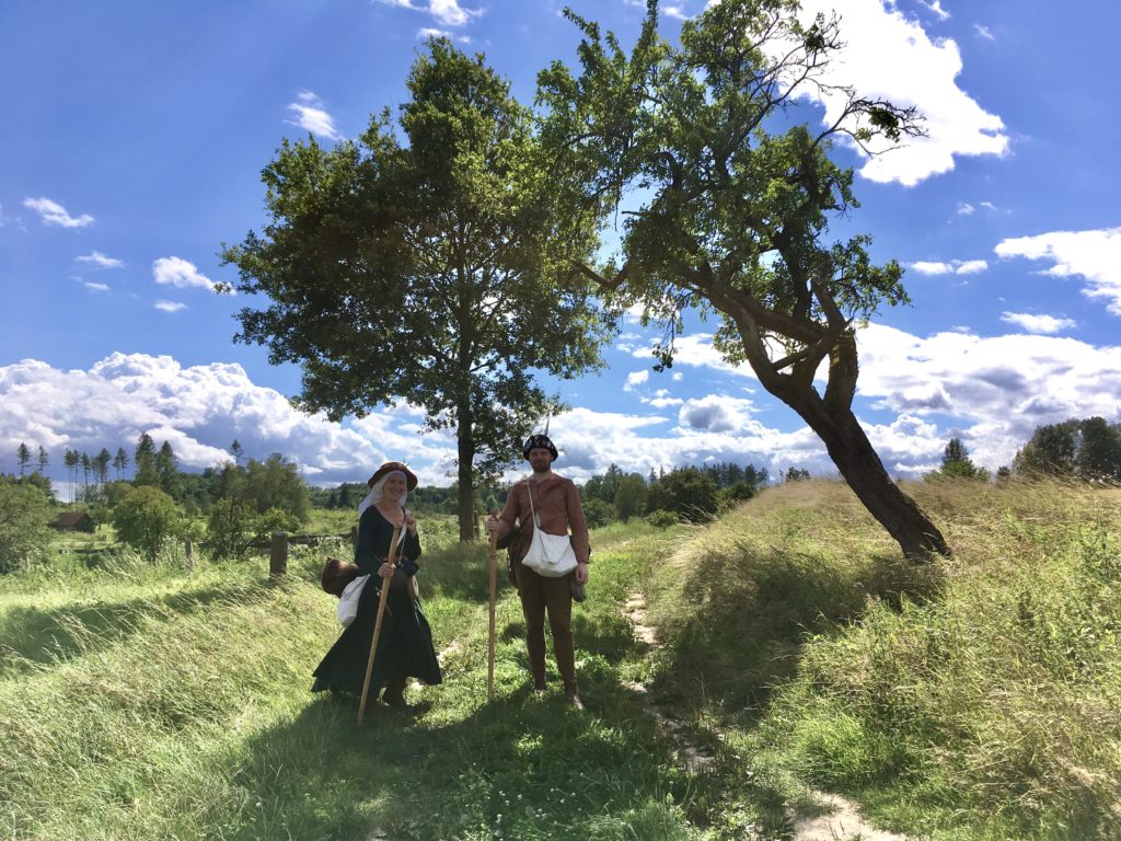
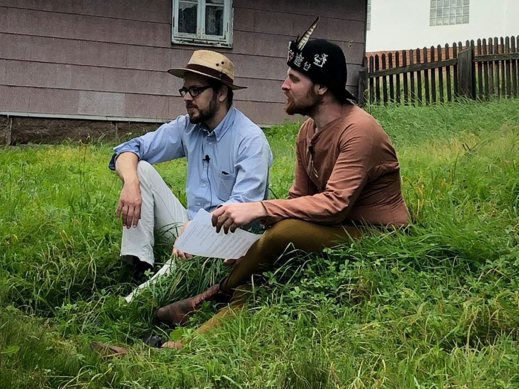
The two historians Mai-Britt and Philipp, who have some really nice living history projects running unter the flag of Histo|Faber, found a charter that mentioned a pilgrim from Hildesheim who had been robbed on his way to Nikolausberg near Göttingen in the year 1401. That pilgrim travelled in late January while Mai-Britt and Philipp opted for late August.
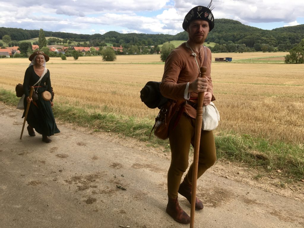
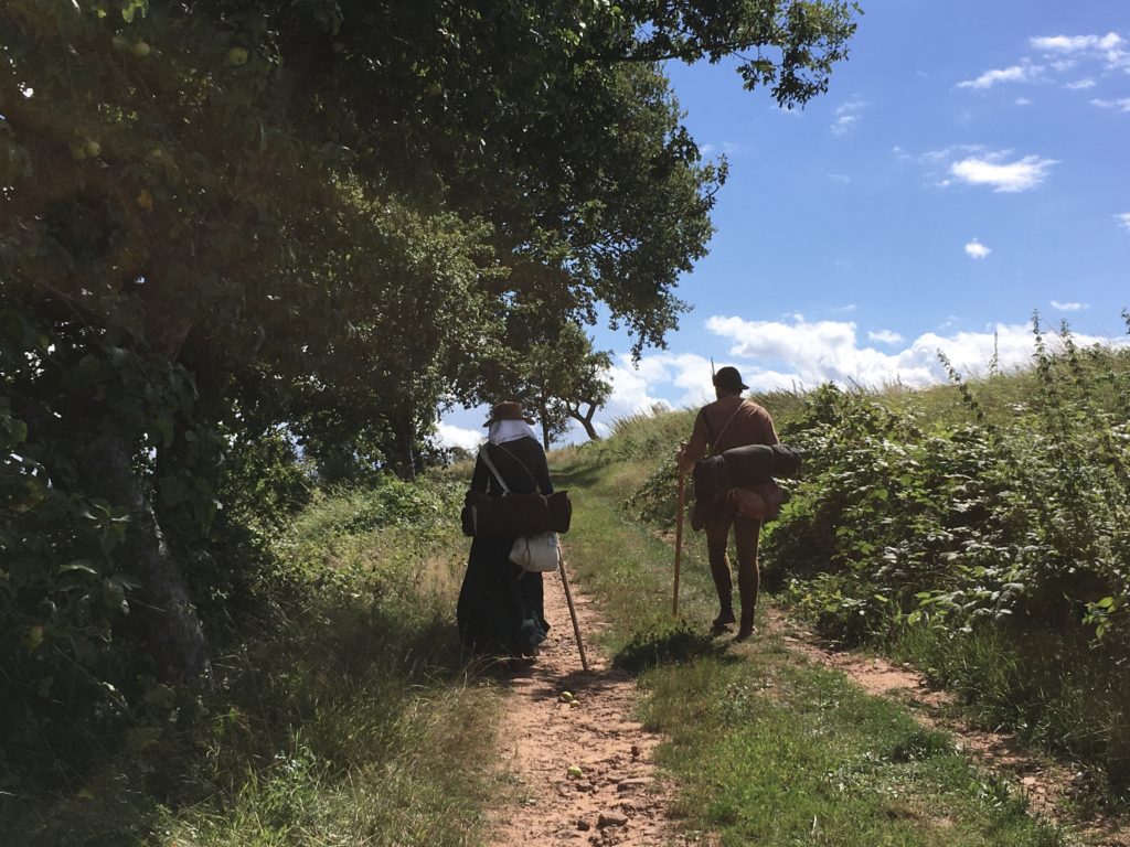
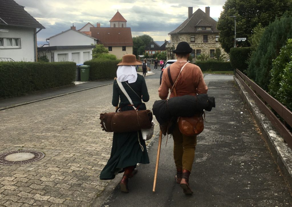
In historical accurate dress and attire, especially in specially manufactured leather shoes they made the 100 km (62 miles) in three days. Some of the Göttingen team joined them for the last 18 km. Niels could ask a few questions about wayfinding, the role of the viabundus-map to which we granted them a special access, and how to interpret the experience in terms of historical insight.
Thanks for your time and for taking us along a bit on your way. What was your original goal in going on “pilgrimage”?
The idea was born a little out of necessity. Together, we maintain the history education project Histo|Faber, which, with the help of Living History, aims to provide insights into late medieval everyday life in northern Germany and thus make history tangible. Normally, we work closely with museums, for example, we are booked for museum events, but this year, of course, this was not possible because of Corona.
So we decided to do our own mediation project and that was this ‘medieval’ pilgrimage in reconstructed equipment on historical paths. We had the idea for such a journey years ago, but we never managed to realise it. Now this was the best opportunity! In order for people to be able to “accompany” us, we documented the journey virtually on our website and our social media channels and provided interesting facts about piety, mobility and pilgrimage in the Middle Ages in blog posts, videos and podcasts. Interested people could thus accompany us live on our journey, ask questions and get in touch with us, while maintaining social distancing. And it really worked very well. We had about 250 live followers, and many more are now reading and listening to the contributions that will gradually appear on our website histofaber.de.
How can living history and reenactment contribute to knowledge about the past? Where are the limits?
Besides the goal of conveying history, we naturally had a very personal motivation for this journey. There were many questions that were still open for us and that visitors to events often ask us. Especially about the equipment, e.g. how the clothes work in practice or how to walk on the reversible shoes (something like better leather stockings). Our equipment is largely based on image sources and archaeological findings, so in theory it corresponds largely to the source situation. However, we had not yet subjected them to practical tests.
Another important question was how many kilometres a medieval pilgrim could walk in a day. Here the sources are very far apart, as are the projections in research. We also wanted to test this for ourselves and found that 25-30km is a very good average – at least for us Moderni with the historical equipment.
So the trip was also a way for us to clarify questions that can only be answered once we have experienced the scenario in practice ourselves. And such a practical test always raises new questions. It helps us to broaden our own view of pilgrimage as a medieval practice and to think in directions that we would never have come upon when doing all “in theory”. On the way with the right equipment, you notice different things than what you would see from a desk in a book.
Nevertheless, these results are of course not scientifically sound in the true sense. Instead, they lack the measurability, the reconstructibility, as required, for example, by experimental archaeology. So we are still walking with modern feet on largely modern road surfaces. A medieval man, who is used to this footwear and had a different ground condition, may have walked quite different distances. Our results are therefore primarily personal experiences that help us to broaden our own perspective.
What Living History can’t do in any case is to take a look into the minds of the people of that time. We often make the experience that people assume that we know what the Middle Ages really were like. We don’t know that and we can’t, because we too are people of the 21st century. For us, Living History is a means of communication.
 click here for a moving image!
How did you determine the route and what problems did you encounter on site when finding the way?
We had planned the route and the daily stages in advance. In doing so, we based ourselves on a pilgrim’s letter from the 15th century, which had also been issued for the route Hildesheim-Nikolausberg. Such a pilgrim’s letter not only states the start and destination, but also the period of time the pilgrim is allowed to be on the way. In the case of the original, this was ten days, in which the pilgrim had to cover the distance of almost 100 kilometres there and back.
If you now take into account that this pilgrim’s letter may also have provided a time buffer – for example, for a storm or unforeseen stops – you arrive at about 3-4 days per direction, i.e. about 25-32km per day.
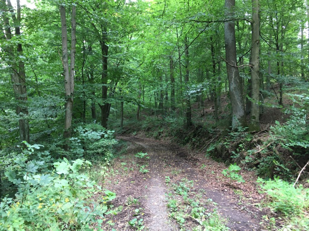
So we had the most important key data. But unfortunately also only those. So we had to research and reconstruct the rest ourselves. For the route planning we had access to the Viabundus-database very early on and could build directly on it. We based our work on the assumption that, on the one hand, we would follow known routes that were used regularly, so that groups could join – long-distance trade routes are therefore ideal – and, on the other hand, we would take the shortest route. From the data, an almost straight line connection between Hildesheim and Nikolausberg resulted, apart from an arc just before Nikolausberg, as the route follows the valley. The villages on top of it formed the new key data in the next course. But since we also had the requirement that the underground should be as close as possible to the historical one, in order to test the reversible shoes on one hand and on the other hand to avoid putting unnecessary strain on our feet and joints, we had to be freer on the lines between the villages. Many of the historic paths are still in their original state, but modernly developed or not suitable for walkers because there is no footpath. Therefore we used the hiking app Komoot in the next step to have a hiking trail between the places we had decided to go through Viabundus, which we could even adapt with regard to the underground. We cannot say whether it was by chance or even because of history, but when we divided the entire route into three stages, there were even overnight stops in places with monasteries, i.e. where one could perhaps offer a bed to a pilgrim rather than if it had been a village of five houses.
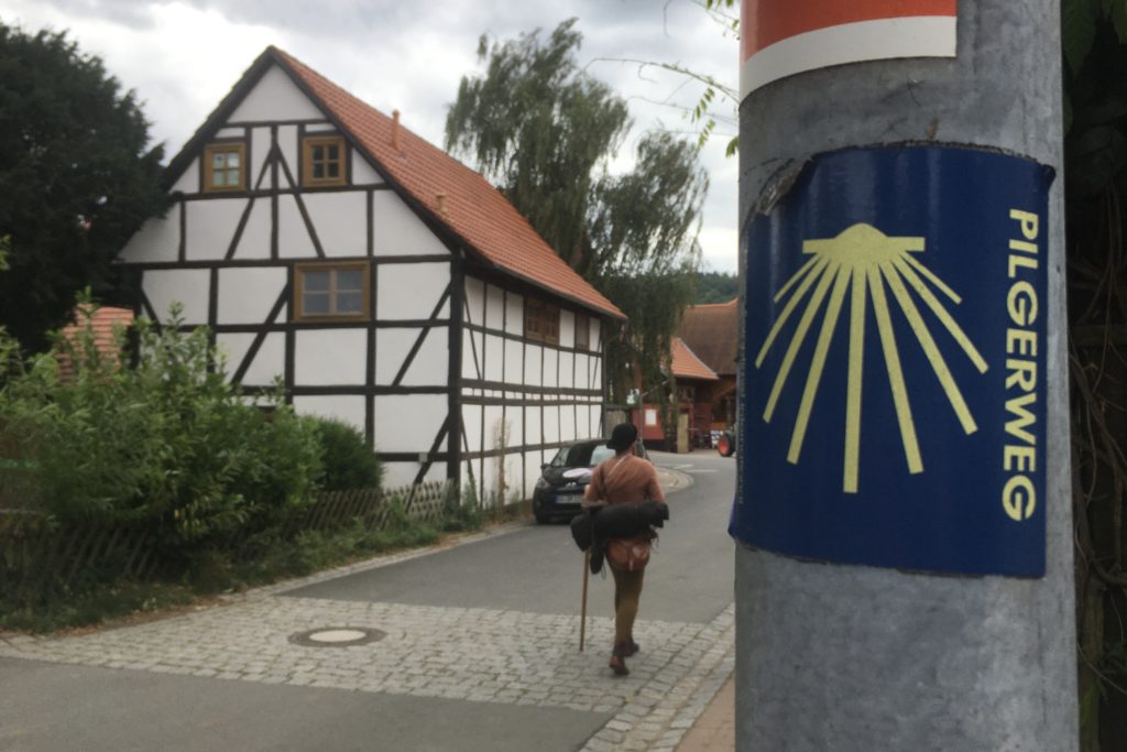
We had no problems finding the way. We always walked on modern hiking trails, and on the second half of the route we even followed the signposted Way of St. James. In towns and cities where you could easily get lost, Philipp had his mobile phone with the route and the coordinates at hand.
You traveled on foot. How fast did you advance and what challenges did you meet in terms of the routes?
We had an average speed of about 4-4.5km/h. That’s a bit slower than the speed we travel on modern shoes over such distances. The braking factors were not necessarily just the shoes, but also the nature of the trail and the tilts and slopes. We had a number of routes that had been designated as trails and were completely overgrown. Slopes can be very difficult, especially in combination with the shoes, because it becomes apparent that the soles have no profile. On asphalt our leather soles were often very slippery.
In the end we were on the road for about 10 hours a day. Of course, this also includes breaks and above all the stops we made on the way, for example to meet interview partners or to shoot videos for our virtual companions.
How was your sense of time, orientation and the perception of the natural environment?
The sense of time is a tricky thing. On previous hikes we have made the experience that people are very relaxed, almost forgetting time as a rhythm. You go out at a planned time, but you take breaks when you feel the need, eat your meals when hunger tells you to, and arrive when you arrive. But there was something about this walk that made us keep an eye on the clock: we had appointments. Similar with orientation: In the first half we had to look at the maps regularly. On the second half, we regularly had the yellow arrows or shell stickers of St. James’s way that helped us, and we could leave the map material in our pockets more often. Longer sections of the path without junctions or forks were relaxing – quite in contrast to the orientation in the city, even in a rather small one like Hildesheim. Unfortunately these two points, the pressure of time and finding our way, often clouded our perception of the environment a little.
What was the importance of social contacts during the trip?
On the way we had two kinds of contact with people. On the one hand, we had to fill our pilgrim bottles from time to time. That was the contact we initiated, for example by ringing the doorbell of the local residents and asking them when there was no way out. Mostly we were looked at a little bit incredulous at first, but 1-2 sentences later they were already enthusiastic about our project. Nobody refused to help us.
The other kind of contact was started by the passers-by, by simply addressing us curiously and asking what we were doing. Here we were also able to present our project in more detail, and to a certain extent we were able to do parts of our mediation work live and in colour. The interest and support helped as much as the water, only in a different way.
You always hear about Compostela, Rome and Jerusalem. From your experience, how important do you consider the closer amd smaller destinations for pilgrimage in the late Middle Ages?
I, Philipp, personally think that in today’s perception the nearer pilgrimage destinations are far too underestimated and forgotten. If one considers the abundance of places that are being found today, several only due to a singular chance find or just a subordinate sentence, one can certainly assume that there were even more destinations that are completely forgotten today. Numerous books of miracles have probably been lost (especially during the Reformation) and not every pilgrimage destination had pilgrim signs. I estimate the historical number to be much higher than known today. And another point is the accessibility. Of course, everyone would like to go on a pilgrimage to Rome, but a 2-3 day pilgrimage a few towns further on was probably easier for many people in terms of time and money. Here, however, I would rather like to refer to the interview we conducted with Dr. Hartmut Kühne, the curator of the double exhibition of pilgrim’s traces in Lüneburg and Stade, in which we addressed precisely this topic, among others.
Translated from German to English with the help of www.DeepL.com/Translator (free version)